Voice and Data Testing with GPS Mapping
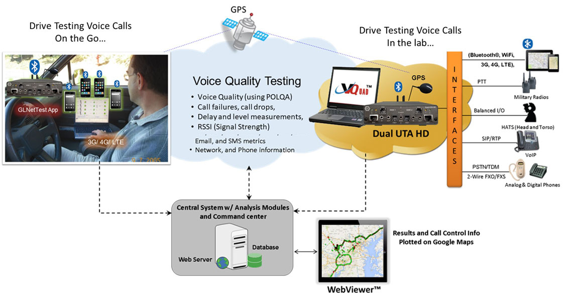
Overview
Providing proper GPS location coordinates is a necessity when performing wireless voice and data testing (drive-by testing). Associating a GPS coordinate with the voice and data test results gives the necessary information when determining why the voice quality in a certain area was good or poor. Using the optional GPS capability along with the GL VQuad™ application for wireless voice and data testing, the user can obtain all necessary GPS location information.
This GPS information is recorded and added to the VQT, EMU, VBA, and GLNetTest reports automatically. The user may search or sort on the GPS information in order to determine the good and poor reception areas. Also, as part of the VQT rating scale, one can better understand where the problematic wireless areas are located.
Functionality
The GPS option in VQuad™ includes the GPS application and a GPS receiver (easily mounted outside of the vehicle). The GPS application includes real-time GPS information including Velocity and True Course as well as the real-time location information that is reported directly to the measuring applications such as VQT, EMU, and VBA applications:
- GPS Timestamp
- GPS Longitude
- GPS Latitude
- GPS Altitude
VQuad™ automatically send the Device PhoneID, Device Name and the Device location of the connected Mobile Devices along with the DataTest results to the central database system, using which the GPS position of the Mobile Devices are mapped in the WebViewer™.
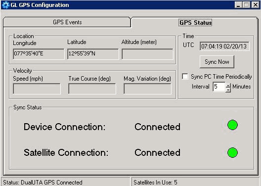
Screen Shot of VQuad™ GPS Device Setup
Results and GPS Mapping
As a result of the Drive Testing and subsequent VQT, EMU, VBA, Fax, Time/Delay measurements, a log is created with all relevant information, including GPS timestamp and coordinates. This logged information can be sent to a central database and accessed via Google Maps feature in WebViewer™.
Google Maps option within WebViewer™ plots various Results, VQuad™ Nodes, and Mobile Devices based on the GPS co-ordinates available. Results include VQT PESQ, VQT POLQA, NetTests, Call Connect Events, EMU, FAX, and VBA tests results. GPS position of Mobile Devices along with the Device PhoneID, Device Name and the location are plotted. VQuad™ Node locations and the VQuad™ Node status such as Down or UP are also plotted. These are differentiated using default color codes and call-outs. Plotting can be done real-time while drive testing and also while testing at different locations world-wide.
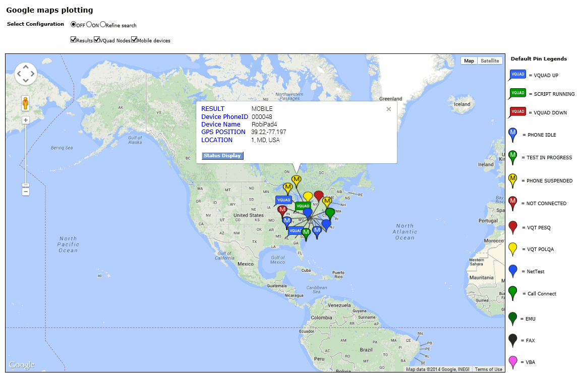
Google Maps Plotting within WebViewer™
The log file so created can also be imported into 3rd party GPS mapping software applications for an overall graphical understanding of the results.
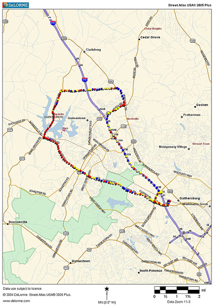
GPS Mapping 3rd Party Software
Resources
Note: PCs which include GL hardware/software require Intel or AMD processors for compliance.
| Item No. | Description |
| VQuad™ Network Options | |
|---|---|
| VQT010 | VQuad™ Software (Stand Alone) |
| VQT013 | VQuad™ with SIP (VoIP) Call Control |
| VQT015 | VQuad™ with T1 E1 Call Control |
| VQuad™ Miscellaneous | |
| VQT251 | Dual UTA HD Next generation Dual UTA with FXO Wideband support |
| VQT252 | Dual UTA HD – Bluetooth Option |
| VQT461 | Dual UTA HD Smartphone ACC Cable |
| VQT | |
| VQT002 | Voice Quality Testing (PESQ only) |
| VQT006 | VQT w/ POLQA Server license (no limitations) |
| VQT007 | VQT POLQA v3, server license for 20 nodes |
| VQT014 | AutoVQT™ |
| VQT014U | Upgrade from VQT POLQA to AutoVQT™ |
| VBA032 | Near Real-time Voice-band Analyzer |
* Specifications are subject to change without notice.