Light Rail Radio Coverage Testing
Coverage map
Client: Maryland Transit Administration, Baltimore (MTA)
Description:
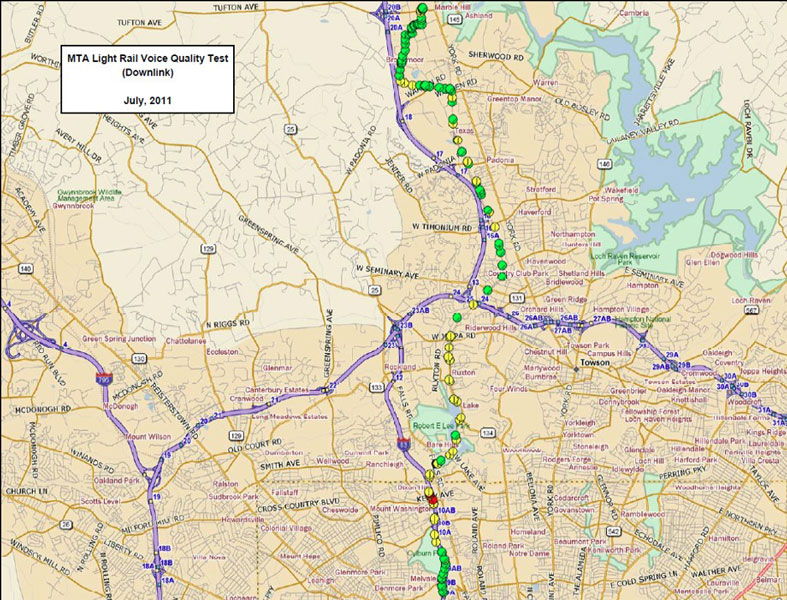
GL Communications Inc. has in-depth experience in providing testing and GIS mapping services to its customers. In a typical scenario, GL identifies the routes that must be drive-tested and plans the test. GL measures Received Signal Strength Indicator (RSSI) and Voice Quality Testing (VQT) scores by driving along the identified routes. After collecting the data, GL processes it and produces geographic maps that show RSSI levels and VQT scores along the routes.
GL uses automated data collection tools for the drive tests. The tools included Anritsu Spectrum Analyzer, Drive Test Utility Software and data processing software from Summitek Instruments, GPS Antenna, and Mapping Software from Delorme. For VQT scores, GL utilizes in-house commercially available test equipment (hardware and software) to accomplish the task. The figure below shows a typical schematic for a 490 MHz trunking system. GL can conduct the drive tests at various other frequencies such as Cellular, WI-FI and FM Broadcast etc.
Project Services and Objectives:
To provide drive testing and GIS mapping (analysis of terrain data, collection and analysis of GPS data, RSSI field strength and Voice Quality scores) for the operating areas of MTA’s Light Rail system.